Home / Makimuku and Hashihaka Kofun
Makimuku Ruins and Hashihaka Kofun
In the farmland of Sakurai City at the foot of Mt. Miwa lies a huge keyhole-shaped mound about 280 m long. This is Hashihaka Kofun. Around it spread the Makimuku Ruins, the remains of one of Japan's largest settlements, which appeared suddenly in the 3rd century. Was this Yamatai, the realm of Queen Himiko?
Labels: Factdocumented Likelysupported by most sources Legendoral tradition Urban legendlocal lore and rumour
A "city" that appeared suddenly in the 3rd century
FactThe Makimuku Ruins are a vast site stretching about 2 km east to west and about 1.5 km north to south. It flourished from the end of the 2nd century to the first half of the 4th century, and a large settlement suddenly arose in a place where hardly anyone had lived before. Few traces of fields have been found, while there are large canal-like ditches and many ritual sites, so it is thought to have been a political and religious centre rather than a farming village.
FactOf the pottery found here, 15-30% was brought from other regions, such as Tokai, Hokuriku, San'in, Kibi (Okayama) and Kyushu (in ordinary settlements it is a few percent). This shows it was a place where people from many regions gathered.
A large building and 2,000 peach pits
FactIn 2009, the remains of large buildings from the first half of the 3rd century were found at the heart of the site. They stood in a straight line along an east-west axis, and the central building measured about 19.2 m north to south and about 12.4 m east to west, among the largest in Japan for the period. It was widely reported as "Himiko's palace?"
FactThe following year, 2010, about 2,000 peach pits were found in a pit nearby. In ancient China the peach was believed to grant long life and ward off evil, and the peaches are thought to have been used in rituals. Radiocarbon dating of the pits was later carried out, and results reported in 2018 placed them around 135-230 CE.
Hashihaka Kofun: the first giant keyhole tomb
FactHashihaka Kofun's mound is about 280 m long, its round rear section about 150 m across and about 30 m high. It was far larger than any earlier tomb, and is considered the first of the giant keyhole-shaped mounds that later spread across Japan. The Imperial Household Agency manages it as "Oichi no Haka", the tomb of Yamato-totohi-momoso-hime no Mikoto, a daughter of the 7th emperor, Korei, and entry to the mound is not allowed.
LegendThe Nihon Shoki tells that Momoso-hime became the wife of Omononushi, the god of Mt. Miwa, but her husband came only at night. When she asked to see his true form, the next morning she found a small snake in her comb box. She cried out in surprise, and regretting it as the shamed god returned to the mountain, she stabbed herself in the private parts with chopsticks (hashi) and died. The chronicle says her tomb was "built by people by day and by gods by night", and that people lined up from Mt. Osaka (thought to be near today's Mt. Nijo) to the tomb, passing stones from hand to hand.
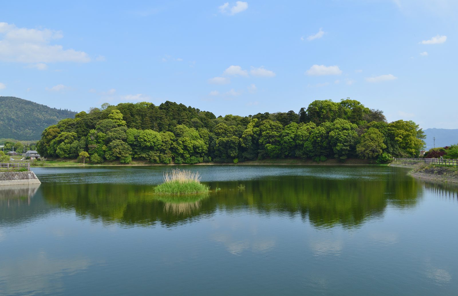
Is it Himiko's tomb?
LikelyThe Chinese history Records of Wei, Account of the Wa says that Himiko, queen of Yamatai, died around 248 and that a great tomb "more than a hundred paces across" was built. Researchers who date Hashihaka Kofun to the mid-3rd century, based on pottery and dating methods, point out that it may be Himiko's tomb.
LikelyOthers date its construction to the late 3rd century, which would fall in the time of Toyo (Iyo), the queen who succeeded Himiko. The "Kyushu theory", which places Yamatai in Kyushu, also remains strong, and the debate is unsettled. Because it is an imperial tomb managed by the Imperial Household Agency, full excavation is not possible, which is one reason the mystery remains unsolved.
Look here: Mt. Miwa seen from Makimuku
Get off at Makimuku Station on the JR Sakurai Line (Man'yo Mahoroba Line), and the site of the large buildings (Tsuji area) is right nearby, with the positions of the pillars marked. Look east from there and Mt. Miwa rises before you (see Mt. Miwa). One view holds that the large buildings were lined up east to west with the direction of Mt. Miwa in mind.
Main sources: Sakurai City Makimuku Research Center / Archaeological Institute of Kashihara, Nara Prefecture / Imperial Household Agency, "Oichi no Haka" / Records of Wei, Account of the Wa / Nihon Shoki, chronicle of Emperor Sujin