Home / Rivers, Moats and Buried Streams
05 — WATER CITY
Rivers, Moats and Buried Streams
Edo was a city of water, like Venice. Moats and canals ran through the town like a net, and both goods and people travelled by boat. Most of them have since been filled in or hidden underground, but look carefully, and memories of water still remain all over Tokyo.
Labels: Factdocumented Likelysupported by most sources Legendoral tradition Urban legendlocal lore and rumour
Edo, a town of canals
FactMany moats and canals were dug through Edo: the moats of Edo Castle, the Nihonbashi River, the Kyobashi River, the Momiji River, the Onagi River and more. For carrying heavy loads of rice and timber, sake and soy sauce, boats were far more convenient than roads. Storehouses lined the landing places known as kashi (riverside wharves), and markets such as the fish wharf and the rice wharf flourished.
The Kanda River was dug by hand
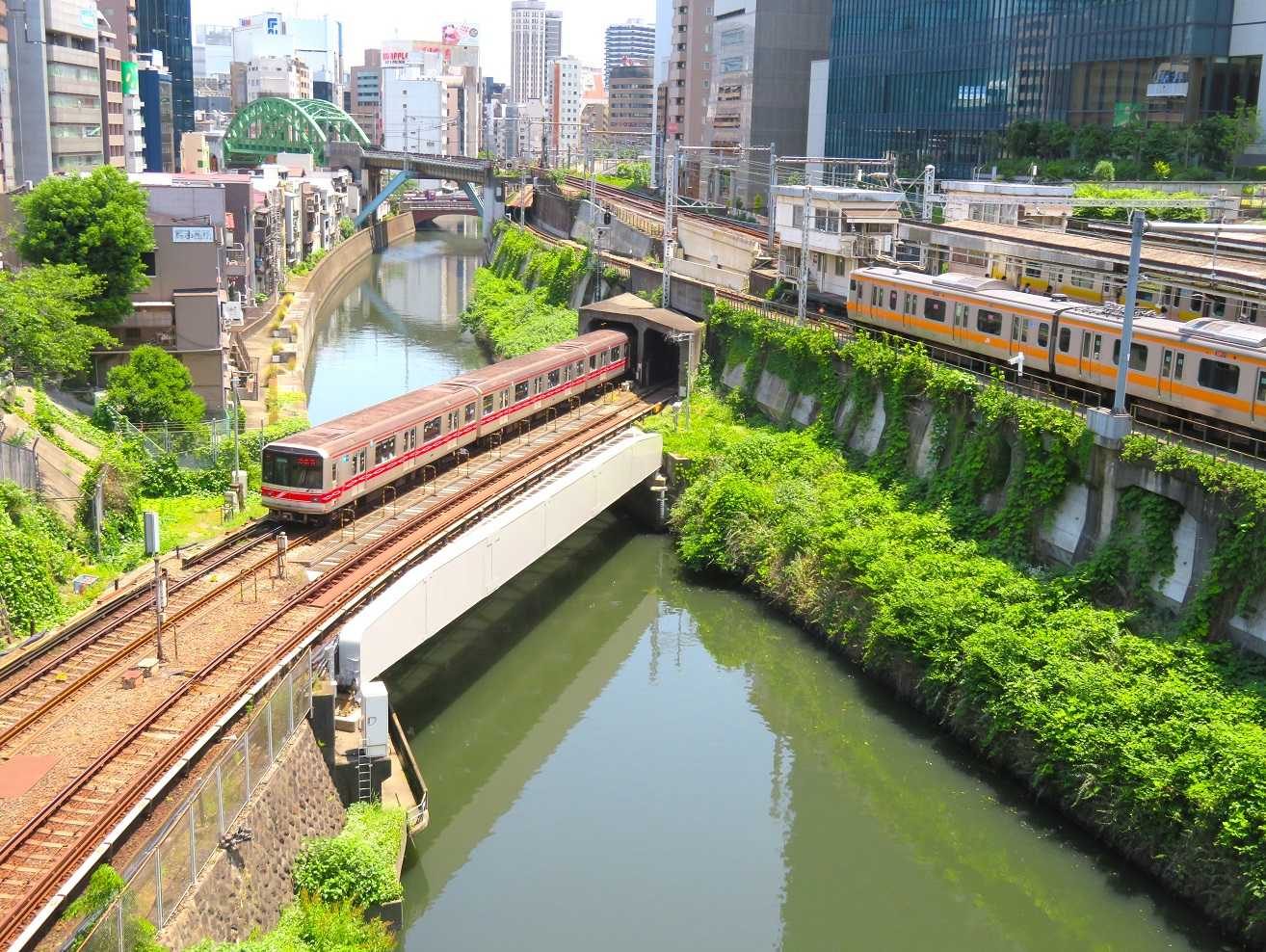
FactOriginally, the lower reaches of today's Kanda River flowed towards Edo Castle and often caused floods. In the time of the second shogun, Hidetada, the Date family and others were ordered to carry out a major project: cutting through the Hongo Plateau to divert the river east into the Sumida. This is why, around Ochanomizu Station, the Kanda River flows along the bottom of a deep valley. This man-made valley was also called "Meikei" and was likened to a famous beauty spot in China.
Look here: the "valley" at Ochanomizu
Try looking down at the Kanda River from Hijiri Bridge. The river runs along the bottom of a deep valley, and above it trains on the Marunouchi, Chuo and Sobu lines come and go. This valley was made by people cutting away the plateau by hand. It is a place that shows just how large the scale of Edo-period civil engineering was.
The "little brook in spring" was in Shibuya
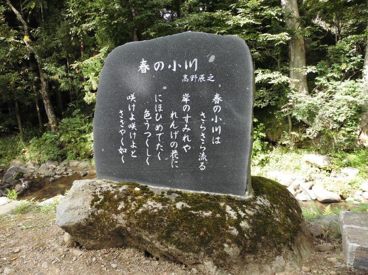
Fact"Haru no Ogawa" ("The Little Brook in Spring", 1912) is a school song known for its opening line, "The little brook in spring goes babbling along" (春の小川は さらさら行くよ). Its lyricist, Takano Tatsuyuki, lived in Yoyogi, and the stream that flowed nearby, the Kohone River, is said to have been his model. The Kohone was a tributary of the Shibuya River.
FactYet today, that little brook is nowhere to be seen. After the war, many of Tokyo's small and medium-sized rivers were covered over for use as sewers and turned into roads and footpaths. A river hidden underground in this way is called an ankyo (buried stream). Beside the Odakyu Line in Yoyogi stands a monument inscribed with the song "Haru no Ogawa."
Why the expressway runs over rivers
FactThe Metropolitan Expressway was built in a hurry in preparation for the 1964 Tokyo Olympics. There was neither the time nor the money to buy up houses and land to make way for roads. So attention turned to the space above rivers and moats. Elevated roads were built over the Nihonbashi, Kyobashi and Shiodome rivers, among others, and moats were filled in and turned into roads.
FactThe moats that surrounded Ginza were also filled in, and the Metropolitan Expressway now runs over them. The reason there are so many place names around Ginza with "bashi" (bridge) in them — Sukiyabashi, Kyobashi, Shinbashi — in places where there is now no river is that there were once moats and bridges there (the Place-Name Trivia room).
How to spot the trace of a river
A narrow road that winds and bends; a road slightly lower than the ground on either side; a long footpath with bollards to keep out cars; the stone posts of a "something-bashi" bridge left standing by the roadside. Places like these may lie on top of a buried stream. Lay the course of the old rivers over a map, and familiar streets start to look completely different.
Main sources: Bureau of Construction, Tokyo Metropolitan Government, "Rivers of Tokyo" / Shibuya City, "Haru no Ogawa" / Metropolitan Expressway Company, "History of the Shuto Expressway"