Reading the landA city floating on water
Kyoto sits in a basin shaped like a horseshoe: the Higashiyama hills to the east, the Kitayama mountains to the north, the Nishiyama range to the west, open only to the south. Over hundreds of thousands of years, rivers pouring off the mountains dumped thick layers of sand and gravel on the basin floor. Rain and river water seep into the gaps and stay there.
Researchers call this underground body of water the Kyoto Water Basin (Kyōto suibon). One estimate puts it at about 21.1 billion tonnes — roughly 80 percent of the volume of Lake Biwa, Japan's largest lake (about 27.5 billion tonnes). Likely In other words, Kyoto sits on nearly a Lake Biwa's worth of water.
That hidden reservoir is why people here could make tofu with well water, rinse dyed silk in streams and wells, and brew sake for a thousand years. The refined culture of the capital was quietly propped up from below.
Reading the land"Going up" really is going up
In Kyoto addresses, heading north is agaru (to go up) and heading south is sagaru (to go down). The usual explanation is that the Imperial Palace lies to the north. But the land itself rises to the north, too.
The basin tilts gently from north to south; between Kyoto Station and Kamigamo in the north there's a height difference of several dozen metres. Fact Cycle through town and the pedals feel mysteriously heavy only when you head north. Students joke that you should pick lodgings so that you ride north in the morning, when you're fresh, and coast home south at night. Urban legend
Solving the mysteryWas the capital chosen by feng shui?
You'll often read that Heian-kyō was sited according to Shijin sōō — the "four guardian beasts" ideal of Chinese geomancy. The Black Tortoise of the north is a hill (Funaokayama), the Azure Dragon of the east a river (the Kamo), the White Tiger of the west a highway (the San'in road), and the Vermilion Bird of the south a lake (Ogura Pond). Likely
A caveat for connoisseurs: which hill and which river match which beast is largely a later interpretation; no document from the founding spells out this table. What the Emperor's edict does say is that "mountains and rivers wrap it like a collar and sash, forming a natural fortress." Fact Defensibility was clearly the point.
Reading the landThe giant lake that vanished
South of the city, where Uji, Kumiyama and Fushimi meet today, there once lay Ogura Pond (Ogura-ike), a lake about 16 km around. Fed by the Uji, Kizu and Katsura rivers, it was a boating spot for Heian nobles and, after Hideyoshi built Fushimi Castle, a key waterway.
Between 1933 and 1941 it was drained and turned into farmland. Fact Ride a train south from Kyoto today and you'll see rice fields that are unnaturally flat. That's the old lakebed.
Reading the landFushimi: "hidden water" and sake
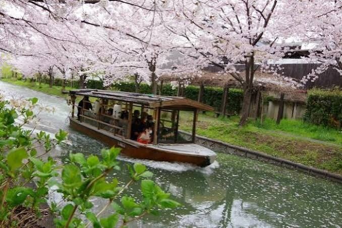
Fushimi, in southern Kyoto, is one of Japan's great sake districts. Its name is said to have once been written 伏水, "hidden water", after the fine spring water that filters under the Momoyama hills. Legend The water is moderately mineral and makes a soft, rounded sake traditionally called "feminine sake" (onna-zake).
Fushimi also boomed as a river port after Hideyoshi built his castle here, linking Kyoto with Osaka by boat. In the 1860s it was lined with boatmen's inns like the Teradaya (see Shinsengumi).
Reading the landThe river that wasn't always tame
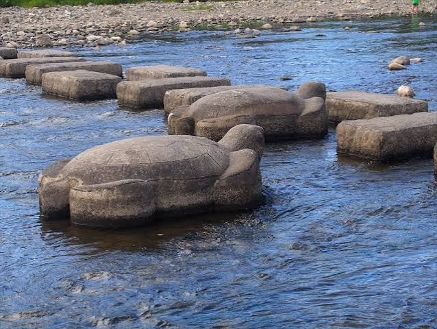
Today's Kamo River is a gentle, embanked stream, but it used to flood again and again. The Tale of the Heike records the cloistered Emperor Shirakawa complaining that three things defied his will: "the waters of the Kamo, the dice of sugoroku, and the warrior monks of Mount Hiei." Fact
A local nicety: two spellings. Above the confluence with the Takano River at Demachiyanagi (the "Kamo delta"), it's usually written 賀茂川; below, 鴨川. Fact Both are read Kamogawa. The turtle- and plover-shaped stepping stones at the delta are packed with kids and students in summer.
Butterfly effectHow the land doomed the west side
Heian-kyō was split by the grand avenue into a left (east) capital and a right (west) capital. But the west side included low, marshy land near the Katsura River, drained poorly, and lost residents early. In 982 the scholar Yoshishige no Yasutane wrote in his essay Chiteiki that the western city was falling into ruin, its houses growing sparse. Fact
So the centre of gravity drifted east, and east again. That's why today's downtown — Shijō-Kawaramachi and Gion — sits at, and even beyond, the old eastern edge of the capital (around today's Teramachi Street). Over a thousand years, the terrain moved the city. The story continues in Heian-kyō: A Capital Haunted.