Home / City of Rivers and Bridges
00 — ORIGIN
City of Rivers and Bridges
Asahikawa is said to have some 160 rivers and more than 700 bridges within its city limits. Even the name "Asahikawa" was born from someone listening to the name of a single river. Here we read the city's origins through its landscape and its names.
Labels: Factdocumented Likelysupported by most sources Legendoral tradition Urban legendlocal lore and rumour
The "knot" where four rivers meet
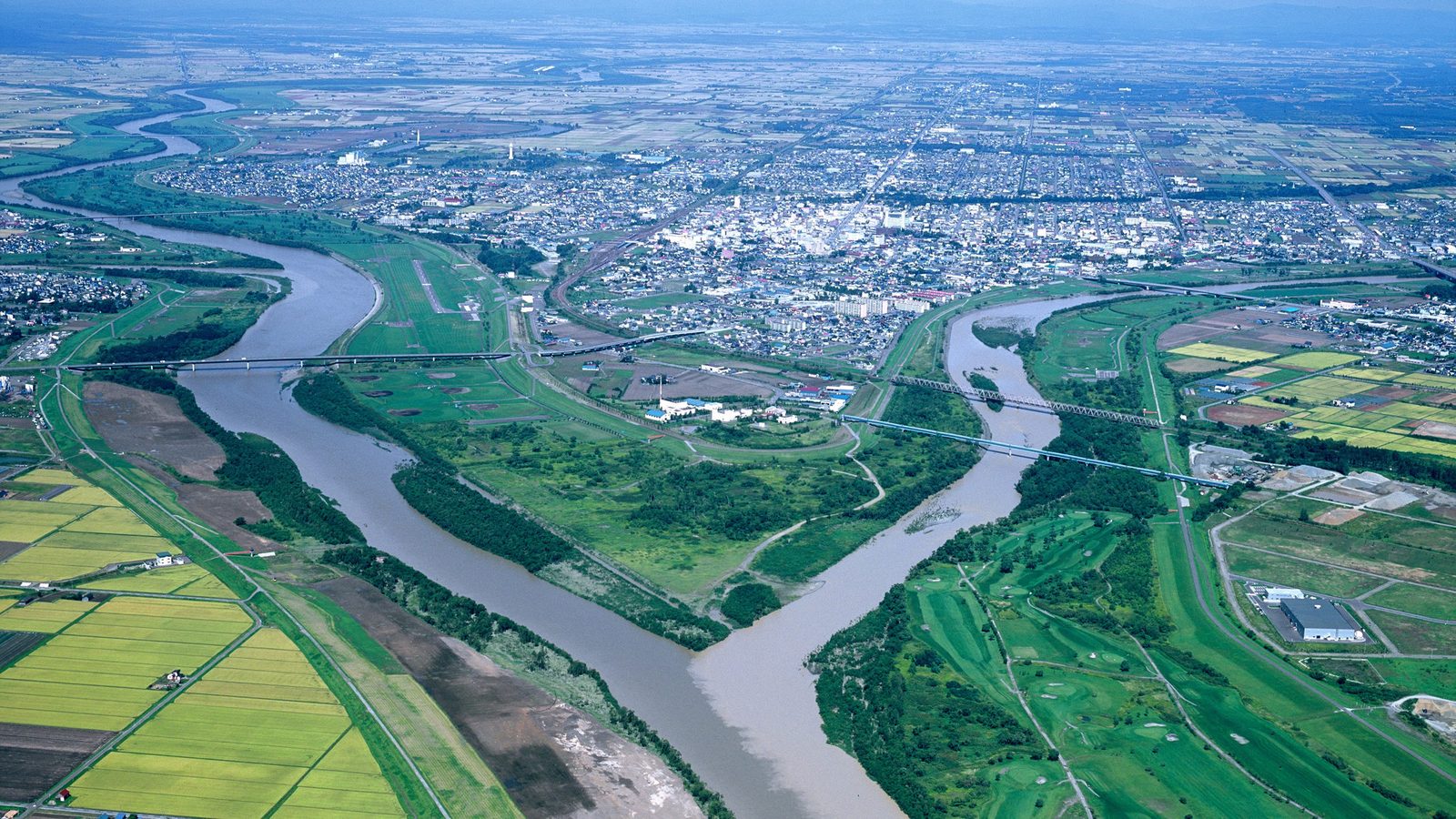
Look at a map of central Asahikawa and you'll see rivers converging on a single point, like the fingers of a hand. Into the main stream, the Ishikari River, flows the Chubetsu River from Daisetsuzan to the southeast; into the Chubetsu flows the Biei River from the south; and from the northeast comes the Ushishubetsu River. All four meet right beside the city center.
The Kamikawa Basin is a flat plain spreading out from the foothills of Daisetsuzan, built up from sediment carried down by the rivers. That flatness is what made it possible to lay out straight roads and a grid of city blocks. Yet the basin has only one exit: the narrow gorge of Kamuikotan. The waters of the Ishikari gather here, then rush downstream all at once.
Look for this: the number of rivers and bridges
According to the Asahikawa Tourism and Convention Association and others, the city has about 160 rivers and about 760 bridges. Driving around, you cross a bridge every few minutes. The slogan "city of rivers" is no exaggeration — it's simply a matter of numbers.
The slightly surprising story behind the name "Asahikawa"
LikelyThe place name Asahikawa is said to derive from "Cup-pet", the Ainu name for the Chubetsu River. Cup means "sun (or moon)" and pet means "river." The standard explanation is that this was interpreted as "the river where the sun rises" and written with the kanji characters 旭川 (Asahikawa, "morning-sun river"). It first became an official place name in 1890, when three villages — Asahikawa, Kamui and Nagayama — were established in the basin.
There is, however, an alternative view. It holds that the name was originally "Cuk-pet" (autumn river) — a river where salmon swim upstream in autumn — and that Japanese settlers either misheard it, or playfully took it to mean "sun." Another theory suggests "Ciw-pet" (a river with rippling waves).
The "river where the sun rises" theory
Cup (sun) + pet (river). The most widely known explanation, also presented by the City of Asahikawa. The town owes its beautiful name to this interpretation.
The "autumn river (salmon river)" theory and others
The view that the name is a mishearing of Cuk (autumn) + pet (river). Given that the Chubetsu was a river salmon swam up, it may be closer to how people actually lived.
Either way, the Chubetsu River lies at the heart of the city's name. "Chubetsu" renders Cup-pet in kanji by sound; "Asahikawa" renders it by meaning. One river gave rise to two names — one transliterated, one translated.
Asahi Bridge — the city symbol that soldiers crossed
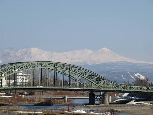
FactAsahi Bridge, spanning the Ishikari River, is the face of Asahikawa. The first Asahi Bridge, built in 1904, was 104 meters long, but it was rebuilt as traffic grew, and the current steel arch bridge was completed in 1932. Yoshimachi Taroichi of Hokkaido Imperial University is said to have guided its design.
What makes the bridge special to local people isn't just its beauty. Asahi Bridge stood on the road linking the town center with the Seventh Division, based on the north side of the Ishikari. During the war, departing soldiers crossed this bridge on their way to the front, and the bridge is said to have been decorated with the Rising Sun emblem. After the war, its meaning shifted from "gateway to the garrison" to "symbol of a city of peace."
Butterfly effect: a town with too many rivers
Lots of rivers and bridges also meant endless trouble with floods and rebuilding bridges. The Ushishubetsu River once flowed right through the town, but in the early Showa era (late 1920s–30s) a major project rerouted its course, and the land left behind became part of today's city center. Moving rivers to make a city — the map of Asahikawa is also the result of a tug-of-war between people and water.
Tidbits to ask a local about
- LikelyChidorigaike Pond in Tokiwa Park is said to be a remnant of the Ushishubetsu River before it was rerouted. Stroll through the park and you can picture the old riverbed.
- FactIn summer, riverbank events and barbecues are hugely popular across the city — rivers are not only something to cross, but also a place to gather.
- LikelyThe Chubetsu River carries snowmelt from Daisetsuzan. The excellent water behind Asahikawa's sake and tofu is supported by this river and its underground flow.
Main sources: City of Asahikawa, "Overview of Asahikawa / Origin of the Place Name" / Asahikawa Tourism and Convention Association (ATCA), "Asahikawa, City of Rivers" / Hokkaido Heritage Council, "Asahi Bridge" / Japan Society of Civil Engineers, Civil Engineering Heritage: "Asahi Bridge"