“A great dry river”—or “a river of vast reed beds”?
The name Sapporo is an Ainu place name written with Japanese characters. Yet even today there are two theories about what it means. Follow the place names, and you can read the nature of the Toyohira River, the flow of settlers, and even the skeleton of the city itself.
Two theories
Sat-poro-pet and Sar-poro-pet
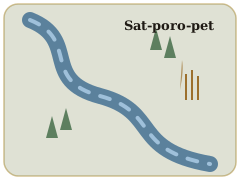
The best-known theory traces “Sapporo” to the Ainu sat-poro-pet: “dry – large – river.”
The other is sar-poro-pet: “reed bed – vast – river.” Both are thought to refer to what is now the Toyohira River.
“A great dry river” sounds strange, but it makes sense. The Toyohira carries huge amounts of gravel, and central Sapporo sits on the alluvial fan that this gravel built.
In such well-drained gravel, river water sinks underground, and in the dry season the riverbed could run dry. The landform itself became the name.
Meanwhile, the low land beyond the edge of the fan was covered with wetlands and reeds. Each theory captures a real side of Sapporo.
Insider note
The name “Hokkaido” also drew on the Ainu language
In 1869, Ezo was renamed Hokkaido. The name was proposed by the explorer Matsuura Takeshiro. One of his proposals was “Hokkaido” written with the characters for kai, which he explained came from a word the Ainu used for themselves. The characters were later changed to “sea,” giving today’s name.
A mystery
Two mountains that swapped names
Mt. Moiwa, famous for its night view, is said to take its name from the Ainu mo-iwa, “small mountain.”
Yet at 531 meters, Moiwa is anything but small when seen from the city. Local history buffs know the puzzle well.
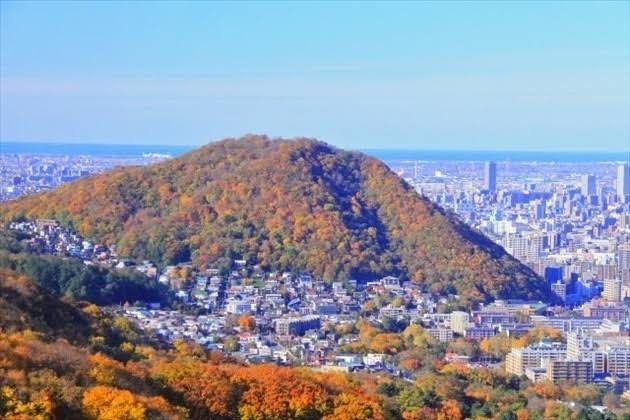
The leading theory is that the Ainu called the smaller neighboring hill, Maruyama (225 m), “Moiwa.”
Today’s Mt. Moiwa was known as Inkarushpe—“the place we always look out from.”
As Japanese mapmakers charted the area after 1868, the name apparently slipped onto the neighboring mountain and stuck.
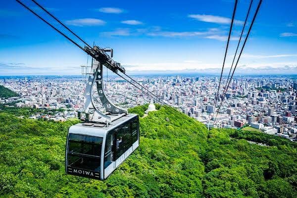
Looking down on Sapporo from the Mt. Moiwa Ropeway—the grid spread across the alluvial fanMaruyama in autumn—thought to be the original “Moiwa”
Interpretations of Ainu place names often differ depending on who recorded them and when. On this page, widely cited theories are presented as “said to” or “thought to.”
Can you read these?
Sapporo place names and their origins
Many place names in the city are Ainu words written with Japanese characters. Knowing their meanings brings the landscape into view.
tuye-pira (crumbling cliff) from the eroding riverbanks
真駒内
Makomanai
mak-oma-nay (river that runs back into the mountains)
手稲
Teine
teyne (wet, damp) said to refer to the lowland marshes
苗穂
Naebo
nay-po (little river)
藻岩
Moiwa
mo-iwa (small mountain) thought to have originally meant Maruyama
琴似・発寒・月寒
Kotoni, Hassamu, Tsukisamu
All derive from Ainu sounds; meanings are debated. Tsukisamu was once also read “Tsukisappu”
簾舞・八垂別
Misumai, Hattaribetsu
Notoriously hard-to-read names in Minami Ward. Hattaribetsu is an old name for part of the ward, still used by locals
Hometowns carried north
A castle town in Miyagi gave its name to a Sapporo ward
Sapporo’s Shiroishi Ward is named after Shiroishi in Miyagi Prefecture. After losing the Boshin War, the retainers of the Katakura family, lords of Shiroishi Castle in the Sendai domain, lost their stipends and in 1871 crossed to Hokkaido in search of a new life.
Some 600 are said to have made the crossing. Impressed by the settlers who began clearing land near Sapporo, Commissioner Iwamura Michitoshi named their village “Shiroishi” after their home.
Such “hometown names” dot the area. Neighboring Kitahiroshima City traces its roots to “Hiroshima Village,” founded by settlers from Hiroshima Prefecture in the mid-Meiji era.
The map preserves the movement of Meiji-era people.
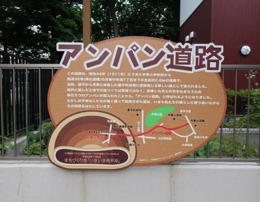
Local know-howThe “Anpan Road” sign in Hiragishi, Toyohira Ward
The “Anpan Road” is real
In Toyohira Ward there is still a road known as the “Anpan Road.” In the late Meiji era, soldiers of the infantry regiment stationed at Tsukisamu were put to work building it, and were rewarded with anpan—sweet bean-paste buns. Together with the local specialty “Tsukisamu Anpan,” it’s a story every local knows.
How addresses work
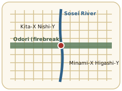
“Kita 3-jo Nishi 4-chome”—counted from where?
Downtown addresses use Odori as the north–south dividing line and the Sosei River as the east–west line, then count blocks outward.
The first block north of Odori is “Kita 1-jo”; the fourth block west of the river is “Nishi 4-chome.” The address is effectively a coordinate—a rare system in Japan.
Head to the suburbs, though, and things change. Areas such as “Hiragishi 1-jo” in Toyohira Ward or “Kotoni 1-jo” and “Hachiken 1-jo” in Nishi Ward use their own local baselines,
so a “jo” and “chome” number there doesn’t match downtown coordinates. That’s why taxi drivers always ask, “Which ward?”
Insider note
The Sosei River began as the “Otomo Canal,” dug in 1866 by Otomo Kametaro. In other words, every “East X-chome” and “West X-chome” in Sapporo is counted from a single canal dug before the Development Commission even existed. More in Who Drew the Grid?
Read next
A City on an Alluvial Fan
The line of springs called “mem,” a 40,000-year-old pyroclastic flow, and the gentle slope to the south.